A short riverside walk at the place where the San Gabriel Valley meets the mountains.
Location
100 N. Old San Gabriel Canyon Road, Azusa, CA 91703, Azusa, Azusa, Los Angeles
A short, family-friendly walk beside the San Gabriel River, with native plants, canyon shade, and a strong sense of where the city gives way to the mountains.
Azusa Canyon Trail begins at the developed entrance to San Gabriel Canyon, where the river, the city of Azusa, and the steep front wall of the San Gabriel Mountains meet. Official descriptions generally call the site Azusa Wilderness Park or River Wilderness Park. From the Hilda L. Solis River Outlook, a roughly one-mile route follows North Old San Gabriel Canyon Road beside the river, making a two-mile round trip.
The walk is modest, but the setting gives it more significance than its mileage suggests. This is one of the clearest places to experience the transition from the built San Gabriel Valley into the mountain watershed that supplies and shapes it. Throughout much of the route, the river remains visible below or beside the road while canyon walls control the light, shade, vegetation, and sense of enclosure.
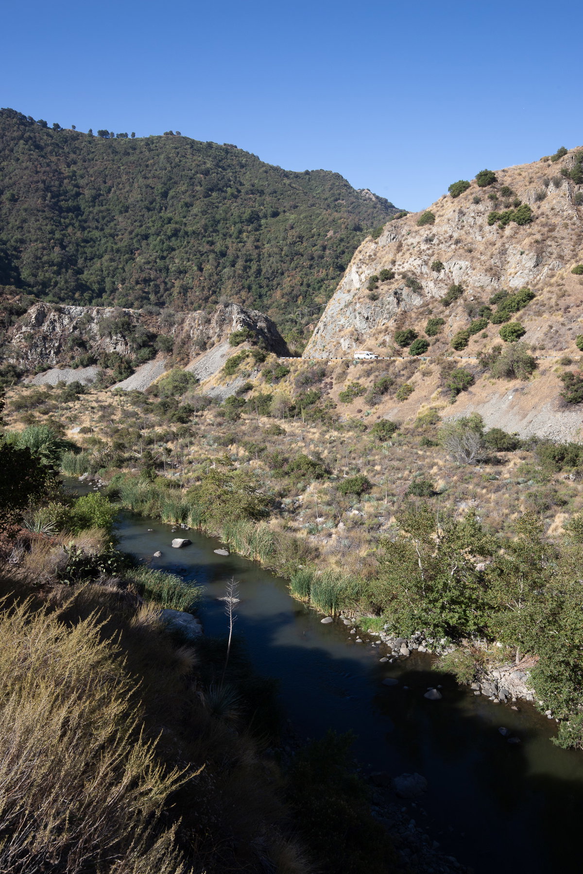
The river curves through the canyon below San Gabriel Canyon Road, emphasizing the narrow corridor shared by water, vegetation, and transportation.
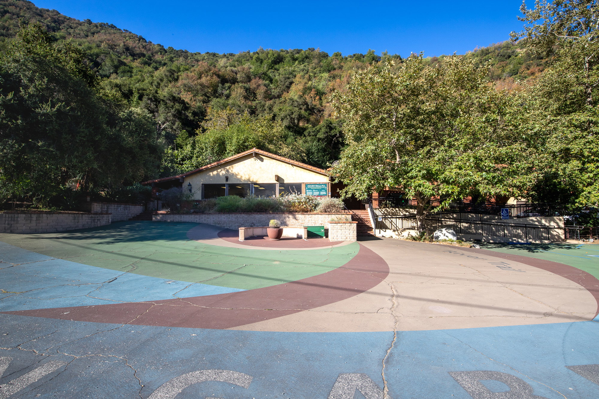
The trailhead includes a visitor center, public-agency offices, a picnic area, native landscaping, parking, and the river overlook. Some of the visitor infrastructure still feels incomplete or lightly used, particularly on a weekday, but there is evident public investment in turning the canyon entrance into a welcoming and interpretable place.
The place
This place feels like several things meeting at once: a short hike, a river overlook, a gateway into the mountains, and an ongoing effort to make the canyon entrance feel welcoming and cared for. It is not quite a neighborhood park, and it does not yet feel like a fully developed nature center. That in-between quality is part of its character.
The former El Encanto property is now home to the Rivers and Mountains Conservancy and the Watershed Conservation Authority. The older building began as a forest-ranger facility and later became a restaurant remembered by many people in the area. Today, the overlook, native garden, picnic shelters, and trailhead improvements are part of a larger effort to make Azusa Wilderness Park a welcoming public threshold to the canyon and the San Gabriel Mountains.
The walk follows an old road rather than a narrow trail, which makes it easy to explore with children or on a casual morning outing. Even so, the river, steep slopes, and enclosed canyon keep it feeling connected to the mountain landscape.
The Hilda L. Solis River Outlook also gave the place a more personal resonance for me. Solis introduced the legislation that created the Rivers and Mountains Conservancy, part of her broader work connecting environmental justice, open-space access, and watershed protection in the San Gabriel Valley. Puja and I later worked as tutors in the same college-access program where she had worked a few years before us, and our manager still spoke about her with real affection. Seeing her name here made the place feel unexpectedly connected to our own history in the valley.
What to see
The main subject is the landscape relationship among river, canyon, road, and mountains. Look back toward Azusa to see how abruptly the urban valley ends, then look upstream as the canyon narrows around the San Gabriel River.
Along the walk, look for sticky monkeyflower, California brittlebush or other sunflower-family blooms, fruiting hollyleaf cherry, riparian growth, exposed rock, and places where groundwater emerges from the mountainside. A small spring or seep can be especially useful for explaining to children that water can move through rock and soil before appearing on a slope without a visible stream above it.
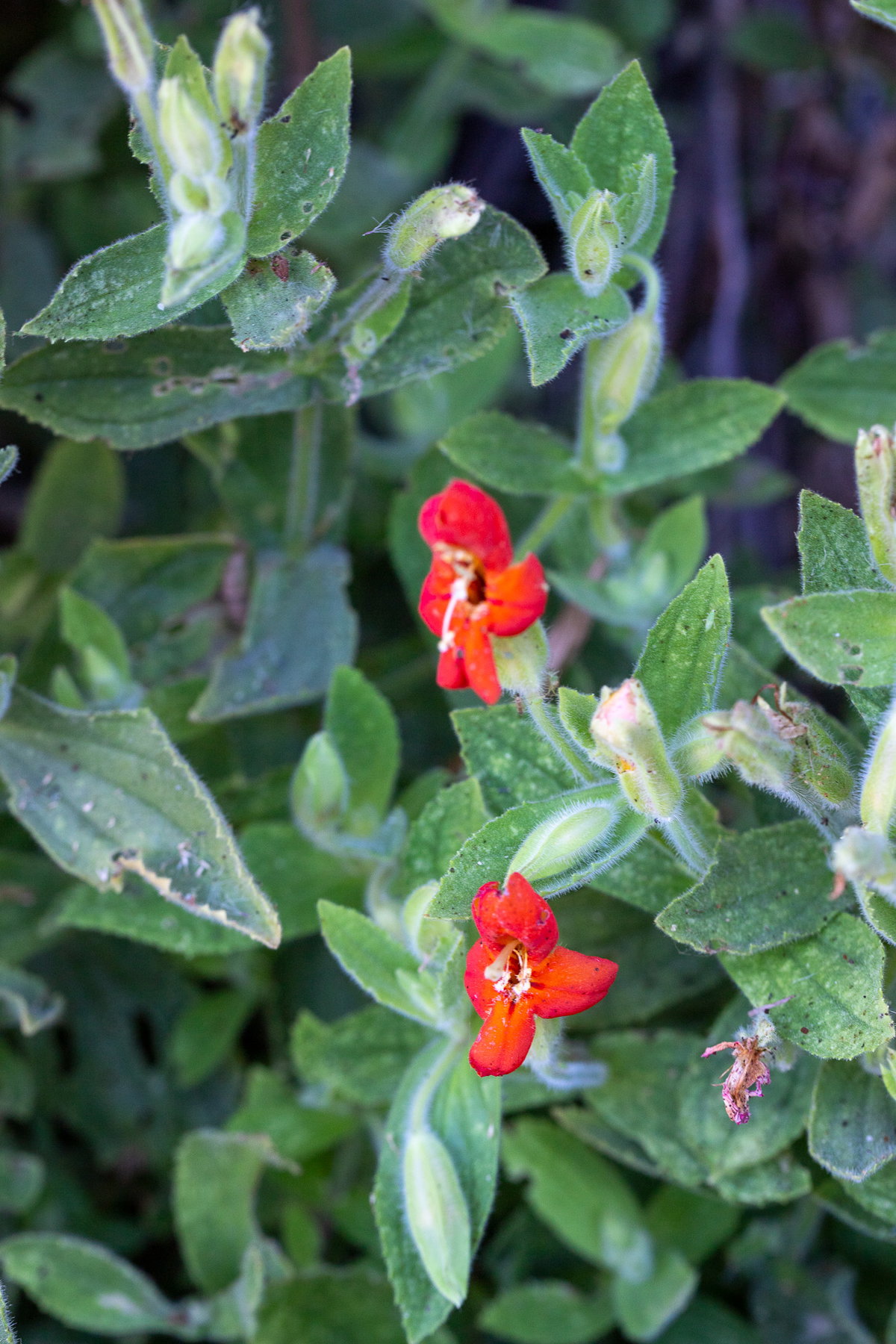
A close view of the tubular flowers and hairy leaves of sticky monkeyflower, a characteristic native shrub of Southern California’s dry slopes.
A private horse stable is visible near the route. Treat it as part of the landscape rather than an attraction: remain on the public route, respect signs and property boundaries, and do not approach the horses or facilities without permission.
At the trailhead, examine the Hilda L. Solis River Outlook, native planting, picnic shelter, interpretive elements, visitor-center buildings, and the remains of the site's El Encanto history.
Field notes
My son and I visited on a Thursday morning and took the short walk up the canyon. The site was largely deserted when we arrived, although a couple of other families came through while we were there. That was enough activity to make the place feel used without taking away from the quiet.
The river stayed with us through much of the hike. Because the trail sits low in the canyon and the sun was still behind the mountains, many sections remained shaded. That made the walk feel cooler and more sheltered than the open foothills nearby.
At one point, several small rocks slid down the mountainside. My first thought was that an animal might be moving above us, and I made sure my son stayed close. I wasn't too worried, but it could be a mountain lion. Or it could have been birds, a squirrel, another small animal, or ordinary slope movement could just as easily have loosened the rocks. The moment was a useful reminder that even an easy walk at the edge of the city is still mountain terrain.
We found sticky monkeyflower, many yellow sunflower-like blooms, and a great deal of hollyleaf cherry carrying fruit. A small spring emerged from the mountainside, creating what looked like a tiny waterfall with no visible river above it. It became one of the best parts of the walk because it gave Milan a concrete way to think about groundwater moving through a mountain.
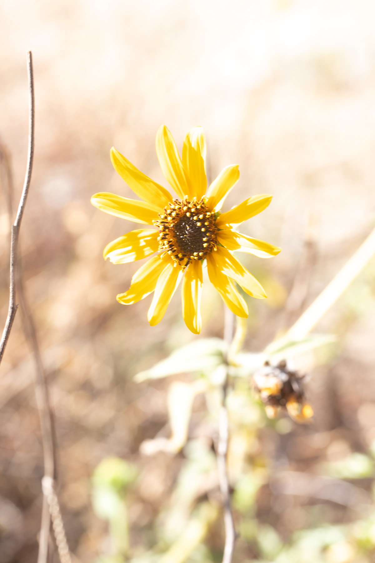
A solitary yellow sunflower catches the intense morning light along a dry section of the canyon trail.
The visitor center and office complex appeared quiet and still in development or transition. Parking was ample on this visit, and the picnic area and shelter at the Hilda L. Solis River Outlook looked ready to accommodate more people than were present. A weekend return would be useful for understanding how heavily the site is actually used.
Native plants
The most notable observed native plants were sticky monkeyflower (Diplacus), fruiting hollyleaf cherry (Prunus ilicifolia), and abundant yellow flowers in the sunflower family. Species-level identification of the yellow flowers should be based on photographs or a confirming field character rather than the general field note alone.
The plant community reflects the meeting of chaparral-covered canyon slopes, alluvial and riparian influence from the San Gabriel River, disturbed roadside habitat, and planted native landscaping around the visitor facilities. Hollyleaf cherry is particularly characteristic of the local foothills and provides fruit and cover for wildlife.
The spring or seep illustrates an important ecological condition. Even a small, seasonally wet patch can support a different set of plants and animals than the surrounding dry slope.
Garden design
The developed portions show how a public gateway can use native planting, shade structures, overlooks, picnic facilities, and interpretation to frame a much larger natural landscape. The strongest design move is not an individual planting bed but the placement of the visitor at the river's edge with the canyon rising immediately beyond.
The site also demonstrates the difficulty of building civic landscapes at the edge of a large watershed. New structures and planted areas must coexist with heat, dust, flood risk, fire, rockfall, changing agency operations, and uneven visitor demand.
The visitor-center complex at the entrance to San Gabriel Canyon, surrounded by mature trees and landscaped public space.
For a home garden, the transferable lesson is to treat water movement, shade, slope, and borrowed views as design materials. A garden does not need to imitate a canyon, but it can reveal where water emerges, use native shrubs as habitat and structure, and create a shaded place from which to observe a larger landscape.
Wildlife
The river, chaparral slopes, fruiting native shrubs, springs, rock faces, and nearby undeveloped mountain land create habitat for birds, small mammals, reptiles, insects, deer, coyotes, bobcats, and mountain lions. A visit should not promise any particular sighting.
Loose rocks falling from above may indicate an animal, but they can also result from birds, small rodents, wind, erosion, temperature change, or ordinary slope movement. Keep children close near steep slopes, avoid standing directly below unstable rock, and give all wildlife space.
Hollyleaf cherry fruit is an important seasonal resource for wildlife. Leave fruit and other natural material in place.
Photography
The strongest photographs place the river against the canyon walls or use the old road to lead the eye into the mountains. The site is also good for documenting the abrupt transition between city infrastructure and mountain watershed.
Morning shade can produce soft light along the trail, but the bright sky and sunlit upper slopes may exceed the exposure range of the shaded canyon floor. Protect highlights and lift shadows later rather than overexposing the rock and sky.
Useful detail subjects include hollyleaf cherry fruit, sticky monkeyflower, springs and wet rock, native landscaping around the overlook, picnic structures, agency buildings, horses viewed from the public route, and the river visible through foreground vegetation.
Visiting with kids
This is a strong introductory hike for children because the route is short, the river remains part of the experience, and there are multiple small subjects to investigate rather than one distant payoff. Plants, fruit, horses, flowing water, springs, rocks, birds, and agency buildings can all become part of the walk.
The mountainside spring is an especially useful teaching opportunity: ask where the water might have entered the mountain and how it traveled through cracks, soil, and rock before emerging.
Keep children close to the inside of the route around drop-offs, traffic exposure, loose slopes, and private-property boundaries. Carry water even for a short walk, and turn around before heat or fatigue becomes a problem.
Home garden takeaways
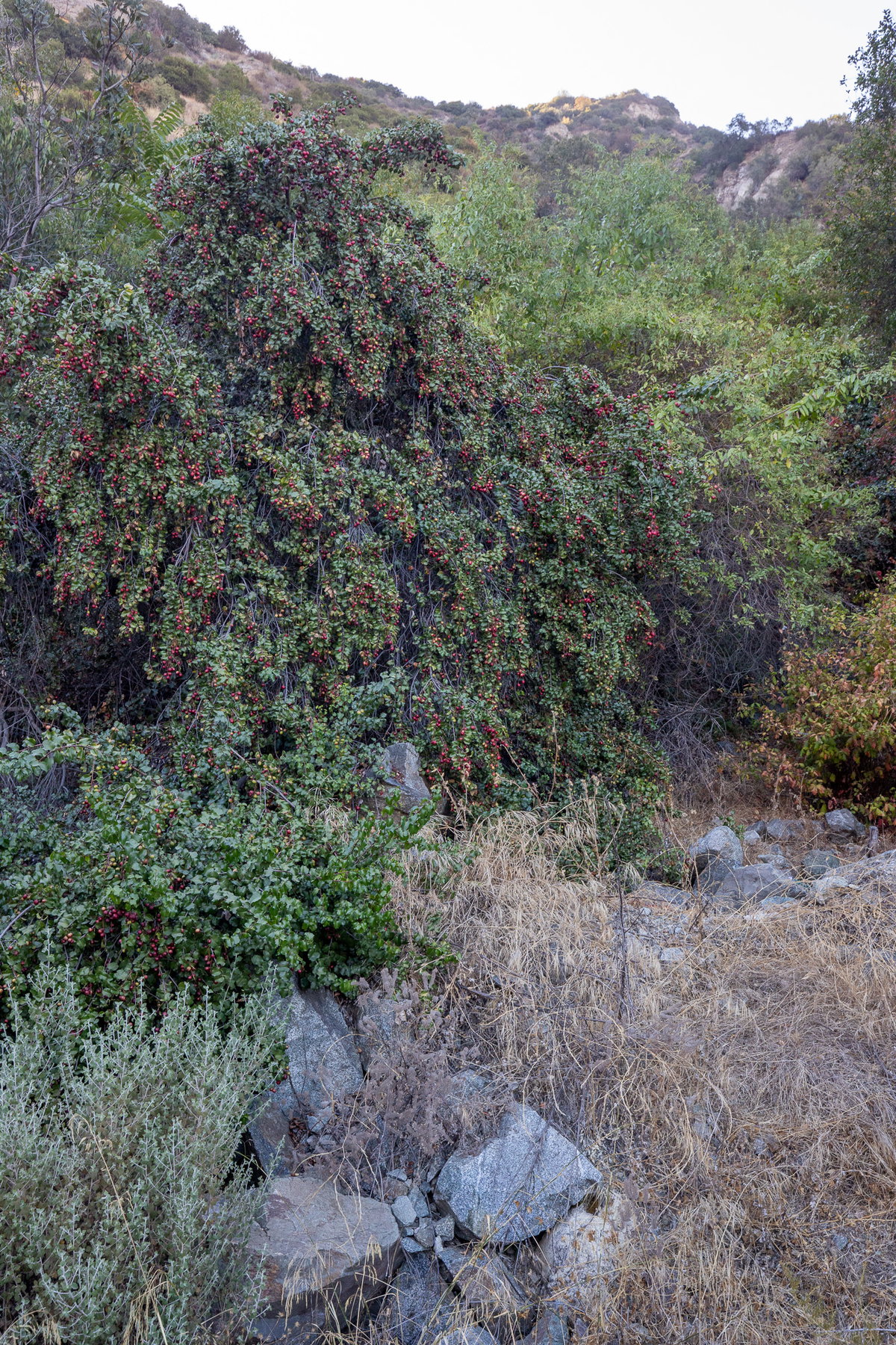
Hollyleaf cherry is the clearest home-garden reference from this visit. In the foothills it functions as a durable evergreen shrub or small tree, produces fruit for wildlife, and visually belongs to the surrounding chaparral rather than appearing imposed on it.
A large hollyleaf cherry carries a dense crop of red fruit beside the canyon trail.
Sticky monkeyflower shows how a relatively open shrub with bright flowers can occupy dry slopes and rocky conditions. Its summer appearance may be less lush than a conventional ornamental shrub, but that seasonal character is part of its adaptation.
The spring suggests a broader design principle: observe where water naturally moves before deciding what to plant. A small seep, roof outlet, swale, or low point can support a distinctly different planting community from a nearby dry slope.
Before you go
Navigate to the San Gabriel Canyon Gateway Center or Azusa Wilderness Park at 1950 North San Gabriel Canyon Road. The public-facing place names are inconsistent, so searching only for “Azusa Canyon Trail” may not produce the best directions.
The short walk begins near the Hilda L. Solis River Outlook and follows North Old San Gabriel Canyon Road for about one mile before returning the same way. Do not enter the adjacent private horse property.
Visitor-center staffing and hours may be limited. Treat the outdoor walk and overlook as the dependable attractions, and verify restroom, interpretive, and office access before relying on them.
Canyon conditions can change rapidly. Check for closures, fire restrictions, high water, storms, extreme heat, and road conditions. Bring water, watch for falling rock, and keep children close.
Parking was ample on a Thursday morning, but the entrance to San Gabriel Canyon can become busy on weekends and warm-weather recreation days. Arrive early when crowds are likely.